Overdue Cascadia megaquake may drown Pacific Northwest coast in minutes, experts warn
05/01/2025 / By Cassie B.
- The Pacific Northwest faces an imminent catastrophic earthquake from the Cascadia Subduction Zone, potentially exceeding magnitude 9.0 and triggering a 100-foot tsunami.
- FEMA estimates 13,000 deaths and $134 billion in damages, with long-term flooding making some coastal areas permanently uninhabitable.
- A new study warns the quake could sink parts of the coastline by 6.5 feet, expanding floodplains and submerging critical infrastructure.
- Tsunami waves could hit within 10-15 minutes, with historical precedents showing permanent land loss and economic devastation.
- Experts urge immediate action, avoiding high-risk construction, as the region faces a 15% chance of a major quake in the next 50 years.
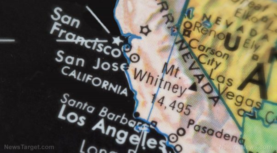
The Pacific Northwest could soon see a disaster unlike any in modern American history, according to experts. A 700-mile-long fault line known as the Cascadia Subduction Zone, stretching from Northern California to British Columbia, is overdue for a catastrophic earthquake — one that could exceed magnitude 9.0, sink entire stretches of coastline by up to 6.5 feet, and unleash a tsunami with waves towering 100 feet high. Scientists warn this “big one” could strike at any moment, leaving coastal residents with as little as 10 minutes to flee before floodwaters swallow their homes.
The threat isn’t theoretical. The last Cascadia megaquake struck in 1700, and geological records show these events recur every 400 to 600 years. Federal Emergency Management Agency (FEMA) projections estimate 13,000 deaths, with economic losses surpassing $134 billion. But new research reveals an even grimmer long-term consequence: permanent flooding that could render entire towns uninhabitable.
Land sinks, waters rise
A study published in Proceedings of the National Academy of Sciences warns that the earthquake’s violent shaking will cause immediate subsidence — coastal land collapsing downward — while rising sea levels amplify the damage. Southern Washington, northern Oregon, and northern California face the worst impacts. In these regions, the floodplain could expand from 35 square miles to 116, submerging critical infrastructure and displacing thousands.
“Today, and more so in 2100 as background sea levels rise, the immediate effect of earthquake-driven subsidence will be a delay in response and recovery,” said Tina Dura, the study’s lead author and a geosciences professor at Virginia Tech. “Long-term effects could render many coastal communities uninhabitable.”
The numbers are staggering. A quake today would expose 14,350 additional residents, 22,500 structures, and 777 miles of roadways to severe flooding. By 2100, with higher sea levels, the floodplain could triple in size. Five airports, 18 critical facilities (including hospitals), and 57 potential contaminant sites like gas stations would be compromised. Farmland soaked in saltwater may never recover, crippling local economies.
A tsunami with no escape
The earthquake’s first blow will be the tsunami. Simulations from the Washington State Department of Natural Resources show waves up to 10 feet high battering the coast within 10 to 15 minutes of shaking. Some models predict 100-foot waves. “The tsunami will come in and wash away and it’s going to have big impacts,” Dura noted, but the subsidence will linger for centuries, reshaping the coastline.
Historical precedents are chilling. The 1700 quake drowned entire villages and left “ghost forests” of trees killed by saltwater immersion. Similar subsidence after Japan’s 2011 T?hoku earthquake caused permanent flooding, forcing relocations. In Alaska’s 1964 quake, roads and docks sank irreversibly.
The Cascadia threat has long been overshadowed by California’s San Andreas Fault, but experts urge immediate action. “Where are you going to put your school or hospital? Where are you going to build your transportation network?” asked Harold Tobin of the University of Washington. Dura’s team advises avoiding new construction in high-risk zones, including parts of Seaside, Oregon, and Grays Harbor, Washington.
Yet with the fault “quiet” since 1700, stress is building. The National Seismic Hazard Model gives a 15% chance of a magnitude-8.0+ quake in the next 50 years. When it hits, the region won’t just shake; it will sink.
For the Pacific Northwest, the question isn’t if but when. And when the Cascadia Subduction Zone finally ruptures, the disaster won’t end with the quake; it will drown the coast in a new reality.
Sources for this article include:
Submit a correction >>
Tagged Under:
big government, California, cascadia, chaos, Collapse, Dangerous, disaster, earthquake, Ecology, environment, flooding, megaquake, national security, panic, prophecy, real investigations, research, SHTF, subduction, tsunami
This article may contain statements that reflect the opinion of the author
RECENT NEWS & ARTICLES